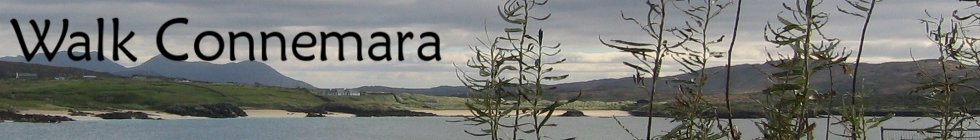
|
Walk Details » Full-Day Hikes Full-Day Hikes from Walk Connemara (Over 5 hours on average)Our most popular walks are listed first. A range of times are indicated for the walks; the lower end is for fast hiking by extremely fit people taking few stops; the upper end is for gentle hiking by people of good fitness but taking plenty of time to stop. Please note that all of these hikes are not on "trails": they involve "off-trail" hiking ("bushwhacking") where there is no obvious path to follow, apart from occasional faint tracks from sheep or other hill walkers. In summer& autumn the grass, ferns and heathers can be very long making it difficult to see where you are puting your feet. Compared with trail hiking, this is much more difficult and takes much longer and requires strong hiking books with good ankle support and grip. Booking is
essential for
all
of the walks; email or call us for details and
booking. A full-day private customised hike currently costs
€250 for up to
8 hours. Tully Mountain  A moderately difficult four to seven-hour coastal hike known locally as Letter Hill. Features quartzite and bright quartz rocks, mountain bog, juniper plants, sea birds and spectacular coastal scenery. Passes an abandoned terrace of old stone cottages and old walls used to dry the turf/peat. Distance is about 12km with about 630m of height gain. Terrain includes rocky mountain tops, open hillside,dense ferns and heathers, wet bog, sheep track and a beautiful quiet road. Requires good fitness, strong hiking boots (preferably waterproof) with good ankle support and grip (trail shoes are not sufficient), along with food, water, outdoor layers (waterproof jacket and pants, hat, gloves and extra layers- no jeans). Tully Mountain is very flexible and hikes can be shortened, if necessary. Click here for Required Equipment. Maumeen to Maumahoge Mountain Hike
A strenuous five to eight-hour mountain hike, including the highest peak in the Maumturks. Features Maumeen (the pass associated with St Patrick), three wild dramatic peaks (Binn Chaonaigh, Barrslievenaroy, Binn idir an Dá Log) and the beautiful mountain corrie lake of Maumahoge. Terrain includes rocky mountain tops, steep open hillside, dense grass and heathers, wet bog, rocky scree, sheep track and paved road. Strong mountain boots with ankle support are necessary for the terrain of wild rocky mountains, open hillside, bog, and minor surfaced roads. The distance is about 12km with 1050m of ascent. Requires a very high level of fitness, strong hiking boots (preferably waterproof) with good ankle support and grip (trail shoes are not sufficient), along with food, water and outdoor layers (waterproof jacket and pants, hat, gloves and extra layers- no jeans). Click here for Required Equipment. Errisbeg Loop including Hill and Beaches
A moderately difficult five to seven-hour loop from
Roundstone including the Wild Atlantic Way Discovery Point, Gorteen beach
and peninsula (in the above picture). Features gabro rocks, mountain bog, heathers, and
spectacular beaches and coastal scenery. Distance is about 15 km with about 470m of
total ascent Mostly off-trail: terrain includes rocky hill tops, open hillside, wet
bog, sheep track, coastal rocks beach and roads. Requires very good fitness, strong
walking boots with good grip & ankle support and multi-layer
outdoor clothes (waterproof jacket and pants, hat, gloves and extra
layers- no jeans) along with food and water. Click here
for Required
Equipment. Introductory Twelve Bens Mountain Hike
National Park Hike tomb")
 A moderate four to six-hour hike in the Connemara National Park from the village of Letterfrack. Going beyond the Diamond Trail into the Glanmore valley - off trail - along the isolated Polladirk river and climbing back up to the remains of a beautiful settlement below Bulog. Passing ancient pre-bog Scots Pine tree stumps, before visiting a megalithic (court) tomb and a spectacular wood. Distance is about 10km with about 400m of ascent, including some steep climbing and descents. Terrain includes rough open hillside, dense grass and heather, stone steps, trail, and surfaced minor road. Requires a good level of fitness and strong hiking boots (preferably waterproof) with good ankle support (trail shoes are not sufficient) and grip, along with food, water and outdoor layers (waterproof jacket and pants, hat, gloves and extra layers- no jeans). A shorter three-five hour version of this walk is also possible. Click here for Required Equipment. Mweelin Mountain Hike
A difficult five to six-hour off-trail mountain hike of three nearby peaks in the wild 12 Bens; Benbaun (Mweelin), Benbrack and Knockbrack. Features significant archaeology (a holy well, a megalithic tomb, a children’s burial ground), beautiful mountain landscape, and part of the Connemara National Park. Distance is about 8.5km with about 700m of total ascent. Terrain includes rocky mountain tops, steep rocky open hillsides, dense grass and heathers, wet bog, sheep track and surfaced road. Requires very good fitness, strong hiking boots (with good ankle support and grip), along with multi-layer outdoor clothes (including waterproof jacket/pants, fleece, hat, gloves - no jeans), food and water. Click here for Required Equipment. Mweelrea A difficult five to eight-hour off-trail hike to the tallest
mountain in Connaught. Features dramatic rocks, spectacular
scenery including mountains, beach, bog and coastline and including the
ancient burial cairn purported to be of Diarmuid O Duibhne (who fled
with Grainne on the eve of her wedding to Fionn MacCumhail). Distance
is about 10km with about 800m of total ascent. Rocky terrain
includes
steep open hillside, wet bog, sheep track and long grass & heather.
Requires very good fitness, a head for heights, and strong hiking boots
(preferably waterproof) with good ankle support and grip (trail shoes are not sufficient),
along with food, water and outdoor layers (waterproof jacket and pants, hat, gloves and extra layers- no jeans).
Click here for Required
Equipment. Benchoona Horseshoe A difficult five to seven-hour mountain hike in the "Northern Bens". Features clonglomerate rocks, mountain bog, spectacular coastal scenery and beautiful lakes. Distance is about 9.5km with about 730m of height gain. Terrain includes rocky mountain tops, steep open hillside, dense grass and heathers, wet bog, sheep track and road. Requires very good fitness and strong hiking boots (preferably waterproof) with good ankle support (trail shoes are not sufficient) and grip, along with food, water and outdoor layers (waterproof jacket and pants, hat, gloves and extra layers- no jeans). Click here for Required Equipment. BenGorm and Ben Creggan A difficult five to seven-hour mountain hike near Leenane at the top of the Killary Fjord and in the middle of several mountains. Features mountain bog, stunning views of valleys, mountains and the fjord. The distance is about 8km (assuming a car drop) with about 800m of total ascent. Involves a steep climb of a narrow ridge with steep drop-offs. Terrain includes rocky mountain tops, steep open hillside, dense grass and heathers, wet bog, sheep track and road. Requires good fitness, strong hiking boots (preferably waterproof) with good ankle support (trail shoes are not sufficient) and grip, along with food, water and outdoor layers (waterproof jacket and pants, hat, gloves and extra layers- no jeans), along with a head for heights. Click here for Required Equipment. 12 Bens TrekA 4-6 hour trek into the heart of the Twelve Bens (or Pins) without climbing any significant peaks. The distance is about 10km with about 360m of total ascent including part of the Connemara National Park. Features two dramatic valleys, a mountain pass with a cave and a beautiful river that has to be waded. The terrain is mostly off-trail with a mixture of bog (can be very wet) and long grass and heathers along with some short rocky sections. Requires good fitness, strong hiking boots (preferably waterproof) with good ankle support (trail shoes are not sufficient) and grip, along with food, water and outdoor layers (waterproof jacket and pants, hat, gloves and extra layers- no jeans). Involves a car drop (or connecting transport which can be arranged). Benbaun and Benfree
Letterbreckaun
A strenuous six to eight-hour mountain hike in the wild Maumturks range. Features spectacular mountain lakes, valleys, streams, passes and peaks (Barrlugrevagh, Letterbreckaun). Terrain includes very rugged rocky mountain tops, very steep open rocky hillside, dense grass and heather, wet bog, sheep track and unpaved road. The distance is about 13km with about 760m of total ascent. Requires a very high level of fitness, a head for heights, and strong hiking boots (preferably waterproof) with good ankle support (trail shoes are not sufficient), along with food, water and outdoor layers (waterproof jacket and pants, hat, gloves and extra layers- no jeans). Click here for Required Equipment. Inishbofin Island Day Trip

A moderate full-day tour of the beautiful island just off the Connemara coast which is a Discovery Point on the Wild Atlantic Way. Features a spectacular natural harbour, beautiful coastline, stunning beaches (rare machair and sand dune habitats), wildlife, great views, maritime history and a vibrant local community. There are several walking options, with distances up to 10km and climbing of up to 350m (Knock) or virtually flat. The terrain is a mix of surfaced roads and track but may include some bog and open hillside. Requires strong hiking boots (preferably waterproof) with good ankle support (trail shoes are not sufficient) and grip, along with food, water (or refreshments can be organised on the island) and outdoor layers (waterproof jacket and pants, hat, gloves and extra layers- no jeans). Derryclare and Bencorr
A strenuous five to eight-hour mountain hike over very rough terrain in the famous Twelve Bens range. Features alpine plants, quartzite rocks, mountain bog, spectacular mountain scenery and beautiful lakes. Distance is about 10km with about 940m of ascent: the descent is quite steep. Terrain includes rocky mountain tops, steep rocky open hillside, dense grass and heather, wet bog, sheep track and unpaved road. Requires a very high level of fitness, a head for heights, and strong hiking boots (preferably waterproof) with good ankle support and grip (trail shoes are not sufficient), along with food, water and outdoor layers (waterproof jacket and pants, hat, gloves and extra layers- no jeans). Click here for Required Equipment Corkóg A tough 5-7 hour mountain hike over the first part of the Maamturks Challenge. Covering Corkog to Maumeen. Terrain includes rocky mountain tops, steep open hillside, wet bog, sheep track. Distance is about 10km with about 700m of ascent. Requires strong boots with good ankle support and grip, along with raingear, warm clothes, food, water and a very high level of fitness. Works best with a car drop. Click here for Required Equipment. Joyce Country Trail HikeA 22km hike on trails and roads starting in Cornamona and finishing in Cong. Includes the wonderful Seanbothar (old road) overlooking Lough Corrib, the village of Clonbur (good refreshments available) and the Clonbur and Cong woods with many interesting features: little-known limestone pavement, spooky old Ballykyne castle, dramatic Pigeon Hole cave and Cong Abbey. South MayoInishturk (North)
 A moderate 4-6 hour island walk over road, track, grass and bog and a chance to experience the life of a small isolated community which is a Discovery Point on the Wild Atlantic Way. Features spectacular sea cliffs, which are rich in bird life and offer challenging rock climbing and superb deep sea diving. During May to mid-July nesting puffins make a dramatic sight. A small population (about 60 people in winter) live on Inishturk. It also has some nice beaches, several interesting archaeological sites and Ordovician geology similar to Croagh Patrick. The rare endangered Spotted Rock-Rose (Tuberaria guttata) plant is found here. Requires a good level of fitness, strong hiking boots (preferably waterproof) with good ankle support (trail shoes are not sufficient), along with food, water and outdoor layers (waterproof jacket and pants, hat, gloves and extra layers- no jeans). Clare Island
A difficult 5-6 hour walk on this beautiful island with sea cliffs and interesting archaeology which is a Discovery Point on the Wild Atlantic Way. The walk starts with a gentle road climb continuing over grassy cliffs before a steep climb to the top of Knockmore then descent to a bog and back to the road. The full distance is about 14km with about 742m of total ascent. In order to complete the walk within the scheduled Ferry times, a brisk pace is needed. Various shorter versions are possible with less distance and ascent. The island is home to a population of about 170 and is also has significant numbers of breeding seabirds (Fulmars and Kittiwakes). The island has Neolithic and Bronze Age archaeology, rare medieval wall-paintings in the 14th century abbey, and one of Grace O'Malley's or “Granuaile’s” castles. The early 1900s Clare Island Survey, by R.L. Praeger, is one of the most important natural history surveys in the British Isles. Requires strong boots, raingear, warm clothes, food, water, a good level of fitness and you need to be able for what can be a rough ferry crossing. Click here for Required Equipment. Croagh Patrick |
The view from Omey Island of the beaches at Fountainhill and the 12 Bens (or "Twelve Pins") in the background
Contact:
walkconnemara@gmail.com
Mobile: 087 6291659
(If Paul is guiding, he may not be able to answer, but please leave a message)


 A
difficult four to six-hour off-trail mountain hike of three adjacent
peaks in the
rugged 12 Bens; Ben
Lettery, Ben Gleniskey and
Ben Gower. Features wild mountain landscape, stunning views and
spectacular blanket bog. Distance is about 8km with about 750m of
height gain. Terrain includes steep rocky and boggy hillside
(requiring the use of hands in places), wet bogland and sheep track.
Requires very good fitness and strong hiking boots
(preferably waterproof) with good ankle support and grip (trail shoes are not
sufficient),
along with food, water and outdoor layers (waterproof jacket and pants,
hat, gloves and extra layers- no jeans). Click here for
A
difficult four to six-hour off-trail mountain hike of three adjacent
peaks in the
rugged 12 Bens; Ben
Lettery, Ben Gleniskey and
Ben Gower. Features wild mountain landscape, stunning views and
spectacular blanket bog. Distance is about 8km with about 750m of
height gain. Terrain includes steep rocky and boggy hillside
(requiring the use of hands in places), wet bogland and sheep track.
Requires very good fitness and strong hiking boots
(preferably waterproof) with good ankle support and grip (trail shoes are not
sufficient),
along with food, water and outdoor layers (waterproof jacket and pants,
hat, gloves and extra layers- no jeans). Click here for
 A
strenuous five to eight-hour mountain hike to two of the 12 Bens
including the highest peak in the Bens and County Galway.
Features dramatic quartzite mountainsides, mountain passes and stunning
valleys, a nice ridge and a beautiful river that has to be waded.
Distance is about 11km
with about 800m of total ascent (one
hard climb and some steep descents). Terrain includes very rocky
mountain tops, steep open rocky hillside, dense grass and heather, wet
bog, sheep track and unpaved road. Requires a high level of
fitness, a head for heights, and strong hiking boots
(preferably waterproof) with good ankle support (trail shoes are not
sufficient) and grip,
along with food, water and outdoor layers (waterproof jacket and pants,
hat, gloves and extra layers- no jeans). Click here for
A
strenuous five to eight-hour mountain hike to two of the 12 Bens
including the highest peak in the Bens and County Galway.
Features dramatic quartzite mountainsides, mountain passes and stunning
valleys, a nice ridge and a beautiful river that has to be waded.
Distance is about 11km
with about 800m of total ascent (one
hard climb and some steep descents). Terrain includes very rocky
mountain tops, steep open rocky hillside, dense grass and heather, wet
bog, sheep track and unpaved road. Requires a high level of
fitness, a head for heights, and strong hiking boots
(preferably waterproof) with good ankle support (trail shoes are not
sufficient) and grip,
along with food, water and outdoor layers (waterproof jacket and pants,
hat, gloves and extra layers- no jeans). Click here for


| Home
| Booking
Enquiries | Walk
Details | Scheduled
Walks
|
Guide Book
| Local
Links
| News
&
Events |
| Terms and Conditions | Data Privacy |
| Terms and Conditions | Data Privacy |
website by Brigid Sealy
© Paul Phelan 2022